Tiruchirappalli District Mineral Foundation Trust
The Tiruchirappalli district is located in the Cauvery River basin and also part of the Cauvery Delta Zone in Tamil Nadu, India.
It is centrally located in the state and has a diverse landscape with fertile plains, valleys, hilly areas, and semi-arid zones.
The Cauvery River flows through the district, splitting it into north and south.
The Cauvery River is the main source of irrigation and drinking water
The Pachaimalai Hills receive high rainfall during both monsoons, making them green and cool throughout the year.
The capital of the district is Tiruchirappalli, also known as Trichy.
During the British Raj, the district was referred to as Trichinopoly, and was a district of the Madras Presidency; it was renamed upon India's declaration of independence in 1947.
The district is spread over an area of 4,404 square kilometres (1,700 sq mi)
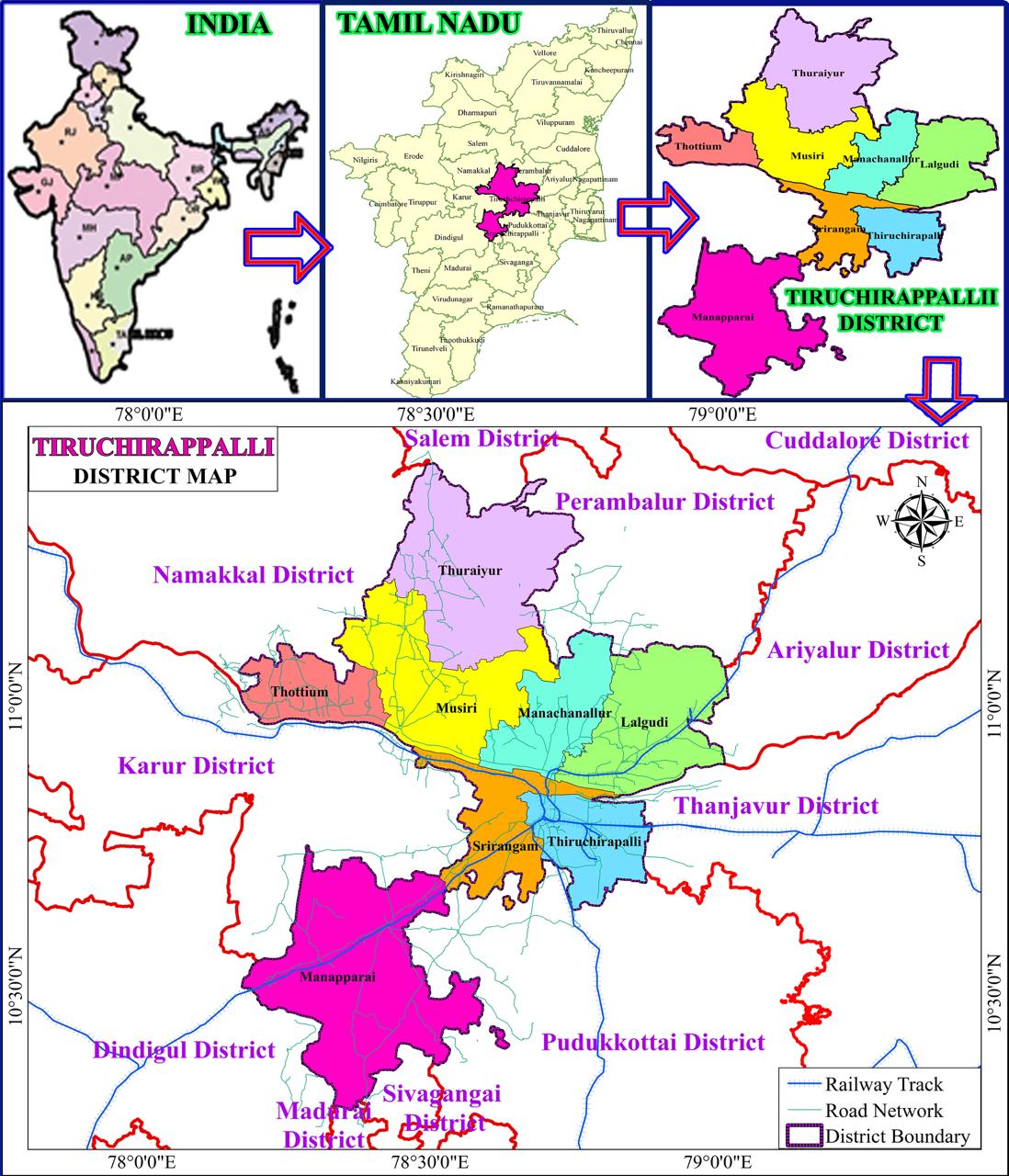
In Tiruchirappalli District has 4 Revenue Division, 11 Taluks, 43 Firkas, 507 Revenue Villages.
The district is located between 78°10'00” E to 79°5'00” E longitude and 10°15'00” N and 11°2'00” N latitude.
The district is bounded in the North by Perambalur and Salem Districts, west by Karur and Namakkal districts, East by Thanjavur and South by Pudukkottai, Dindigul and Sivaganga Districts. It is situated 326 Kms South of the State Headquarters of Chennai.